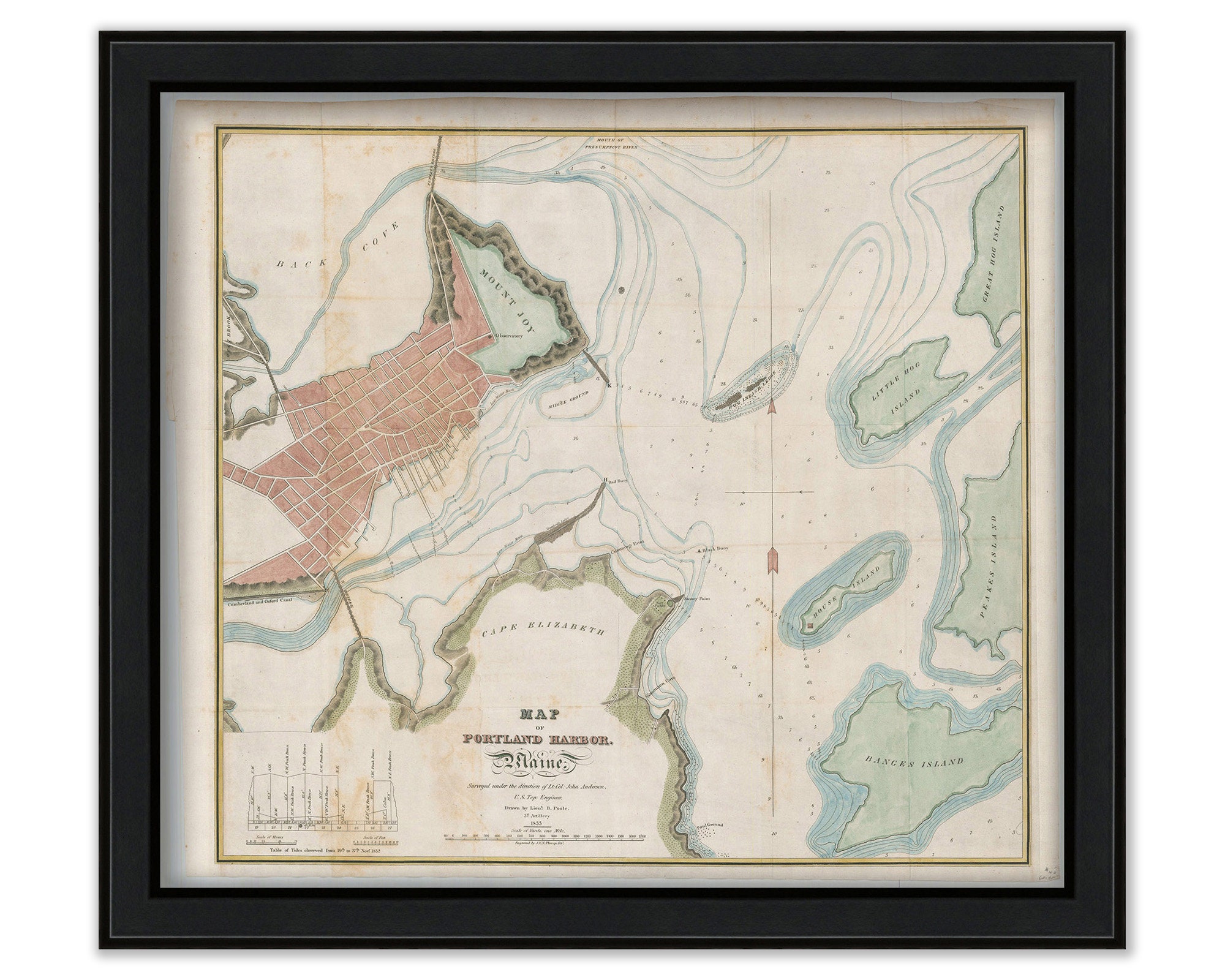
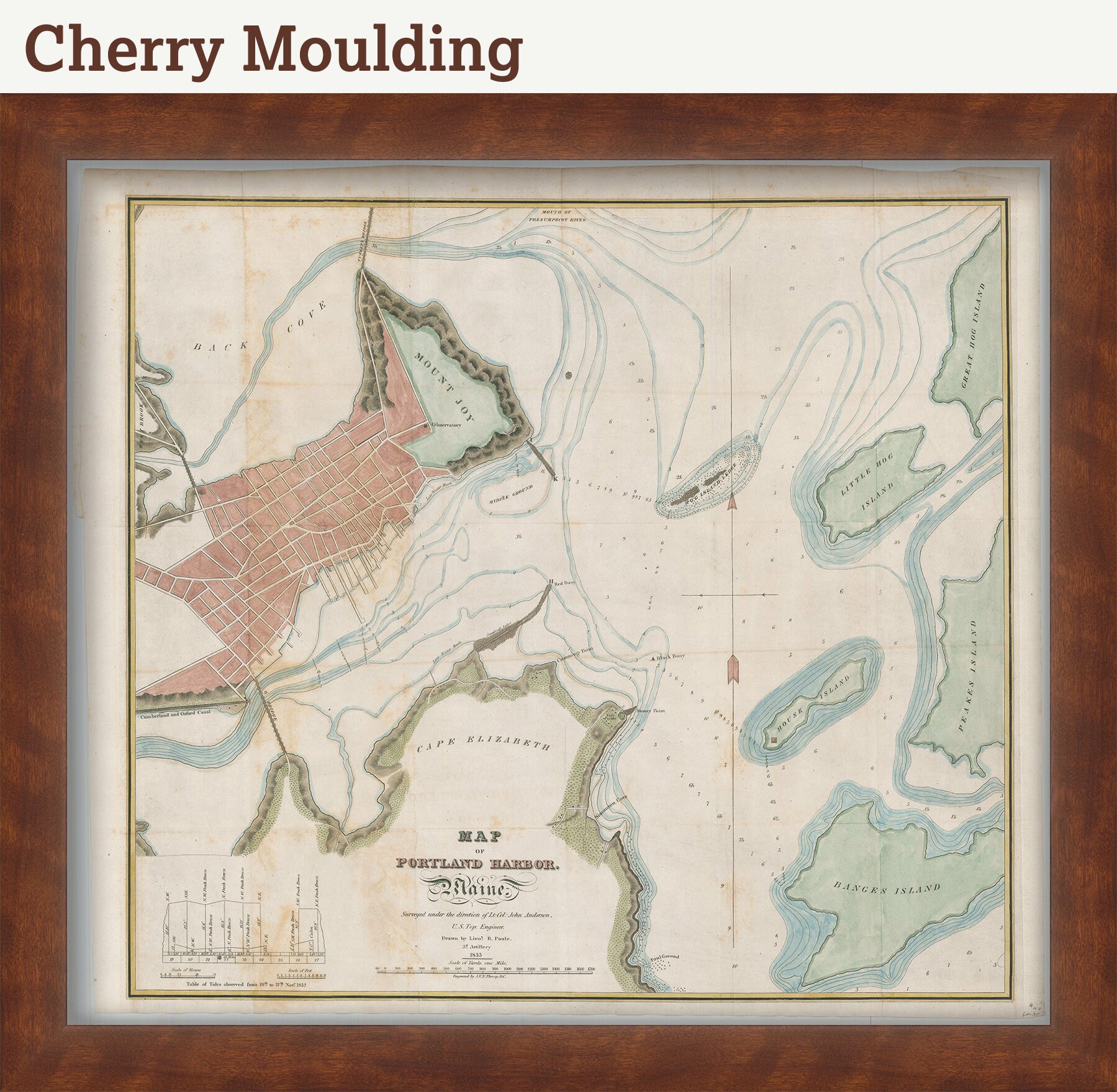

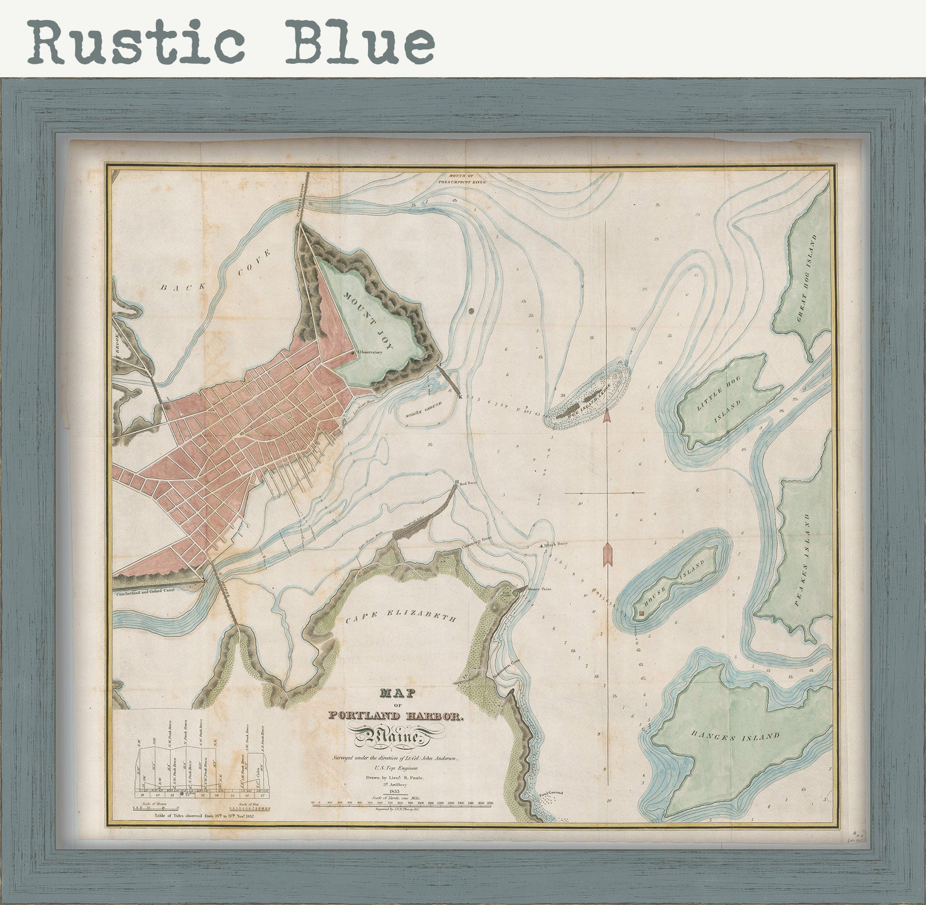
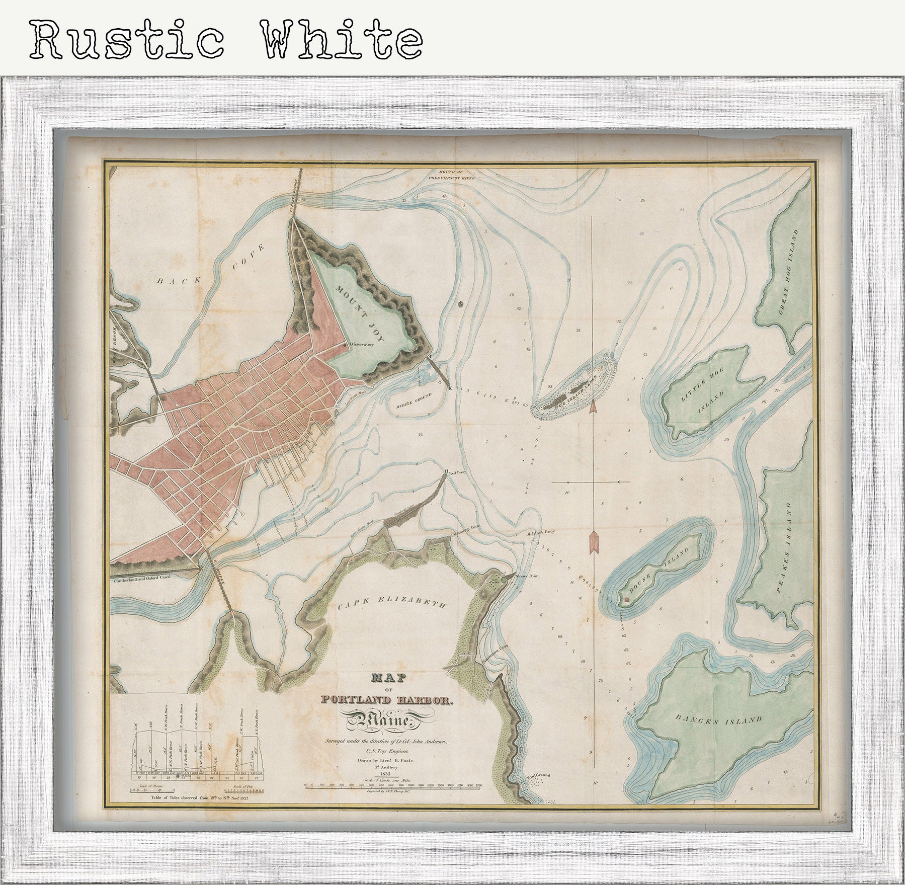
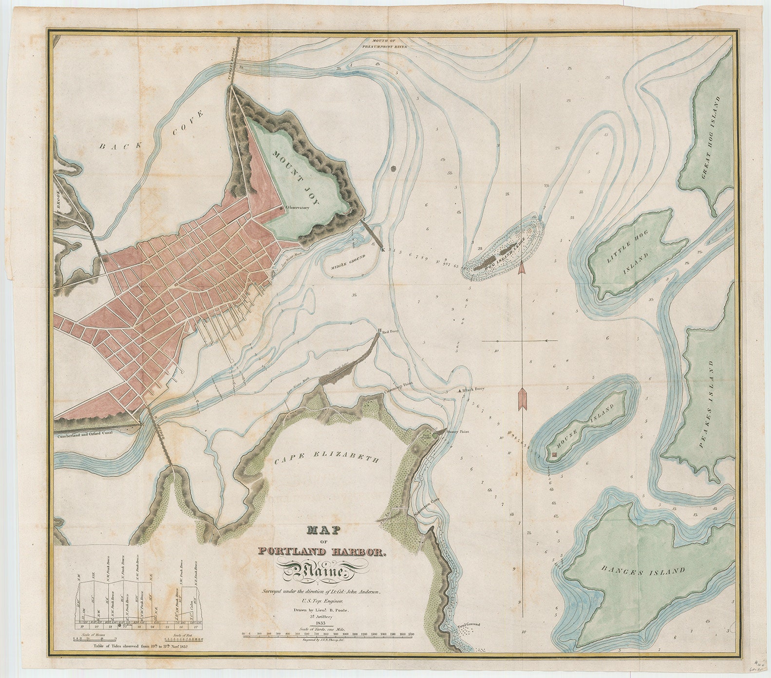
Portland Harbor, Maine 1833 - Nautical Chart by Edmund Blunt
$50.00
A Reproduction Nautical Chart of Portland Harbor by Edmund Blunt originally published in 1833.
Edmund Blunt [1799-1866] was the son of New York publisher Edmund March Blunt. He worked as a surveyor for his father’s company and eventually became assistant to Ferdinand Rudolph Hassler on the U.S. Coast Survey.
Please feel free to use our high resolution version of this map for your research or just to inspect it, If you are interested in purchasing the original map, the unedited scan of the map can be viewed here: please copy and paste this url into a new tab in your browser:
http://rmicusec.sirv.com/etsy/10165.jpg
Dimensions of the Map are: 23" wide by 20" tall
Framed Dimensions are: 26" wide by 23" tall
Framed items include: choice of frame, drymounting, UV protectant glass, ready to hang.
Custom sizes are available. If you are interested in a custom size, please let us know through the "ask a question" button in this listing
The replica (i.e. reproduction) version of this map is available for $32.
This map has been scanned at 600 dpi using state of the art equipment. The replica map is printed on heavy matte fine art paper using archival pigment inks.
Replica maps are available framed for $165.
0537
Shipping from United States
Processing time
1-3 business days
Customs and import taxes
Buyers are responsible for any customs and import taxes that may apply. I'm not responsible for delays due to customs.
Payment Options
Returns & Exchanges
Returns & exchanges not accepted
But please contact me if you have problems with your order
I gladly accept cancellations
Request a cancellation within: 1 hours of purchase