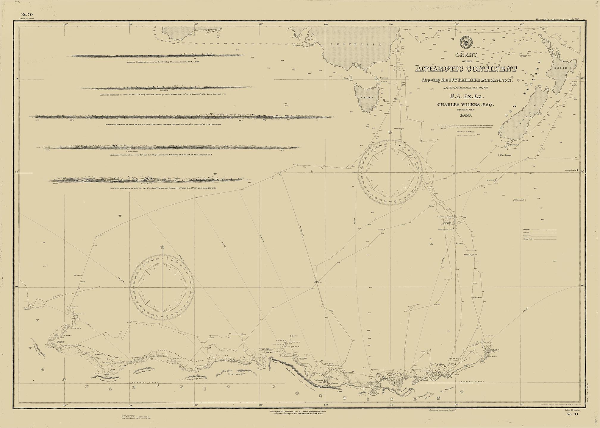

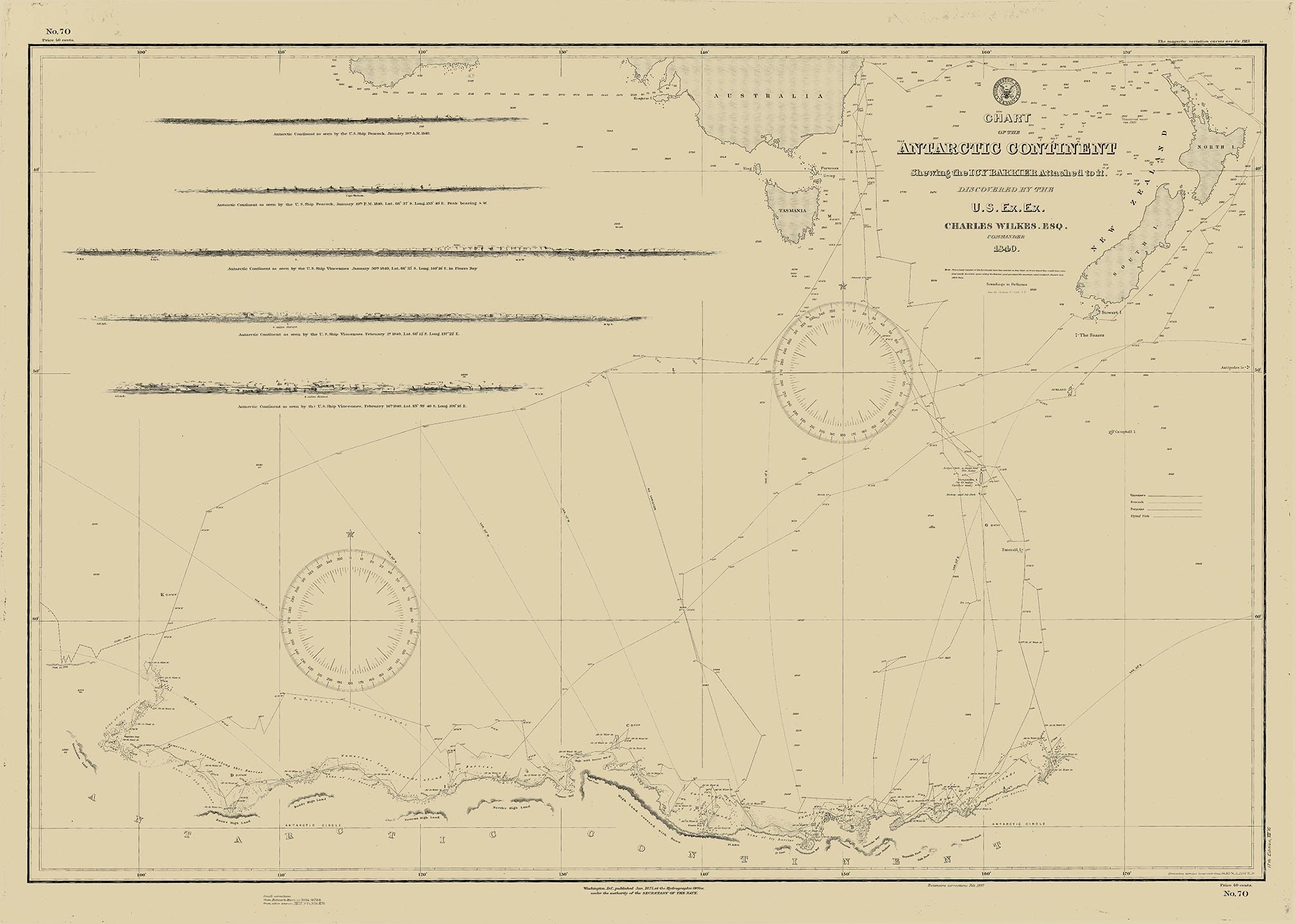
Antarctic Continent by the U.S. Exploring Expedition, 1838–1842
$44.00
A Reproduction of a Nautical Chart of Antarctic Continent by the U.S. Exploring Expedition, 1838–1842.
Exploring the World
Throughout the 19th century, Congress funded expeditions to explore land and sea. In 1836, Congress authorized the United States Exploring Expedition—also called the Wilkes Expedition after its leader, naval officer Charles Wilkes. Its purpose was to circumnavigate the world, promote commerce, and "extend the bounds of science and ... Knowledge." The four-year expedition mapped South Sea islands and Pacific coastlines, established trade, and gathered voluminous information that aided the United States in becoming a leading scientific and naval power.
ARCHIVAL INKS ON HEAVY MATTE FINE ART PAPER
Framing is available.
Framed replica maps include dry mounting, UV filtering glass, and your choice of six mouldings, wired and ready to hang upon delivery. All mouldings are approximately 1.5" wide. Please factor in an additional 3" to the listed size for framed items.
Custom sizes are available. If you are interested in a custom size, please let us know through the "ask a question" button in this listing.
This image is printed on heavy matte fine art paper with archival inks. Framing is available. Framed charts include drymounting, UV filtering glass, and your choice of six mouldings, wired and ready to hang upon delivery. All mouldings are approximately 1.5" wide. Please factor in an additional 3" to the listed size for framed items.
Retailers who would like to carry our Maps and Prints, please contact us through the "ask a question" button in this listing, for information and discounts.
All sizes are approximate, we round up or down to the nearest inch.
2575
Shipping from United States
Processing time
1-3 business days
Customs and import taxes
Buyers are responsible for any customs and import taxes that may apply. I'm not responsible for delays due to customs.
Payment Options
Returns & Exchanges
Returns & exchanges not accepted
But please contact me if you have problems with your order
I gladly accept cancellations
Request a cancellation within: 1 hours of purchase