NARRAGANSETT BAY, Rhode Island - Nautical Chart by Des Barre 1776
$25.00
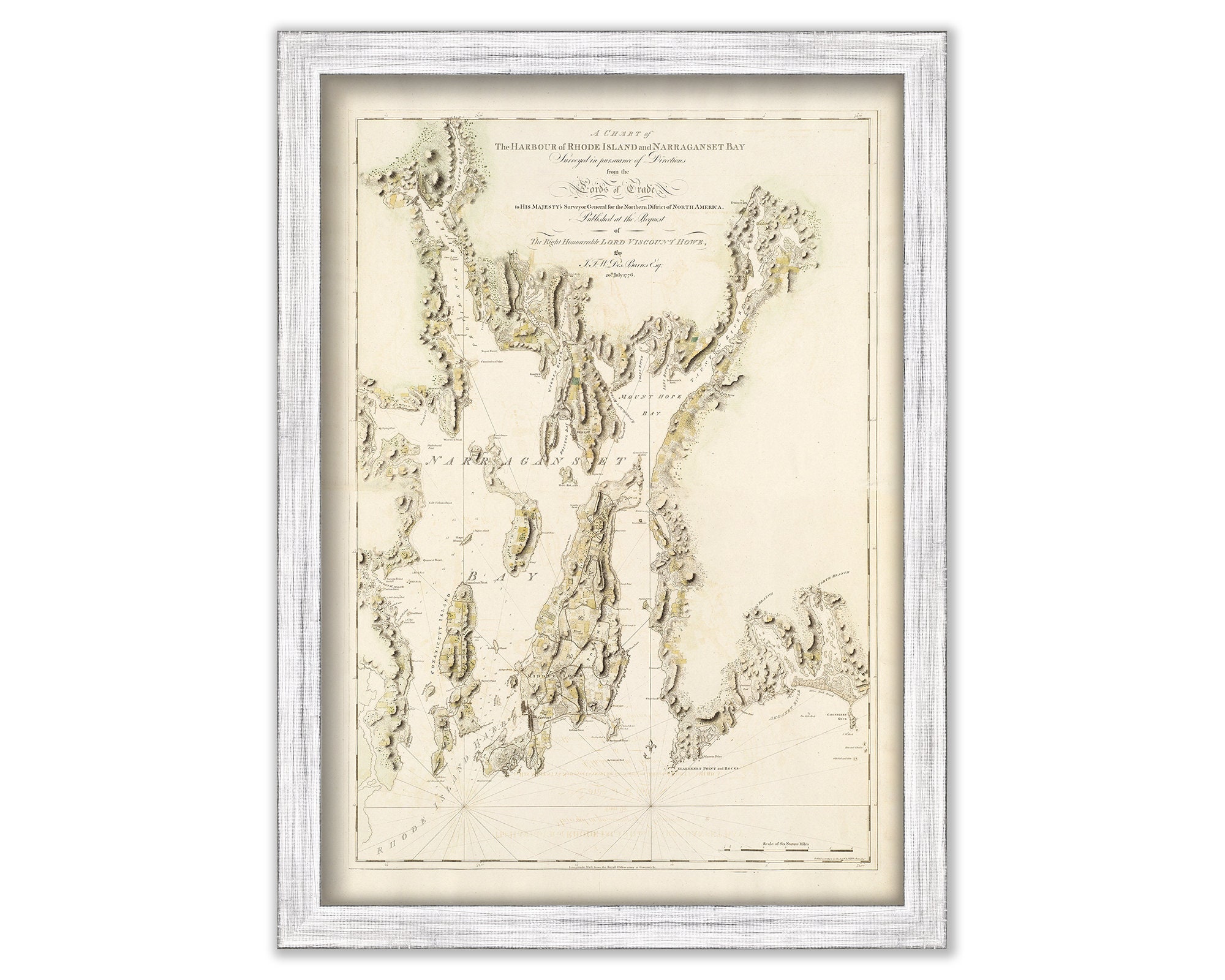
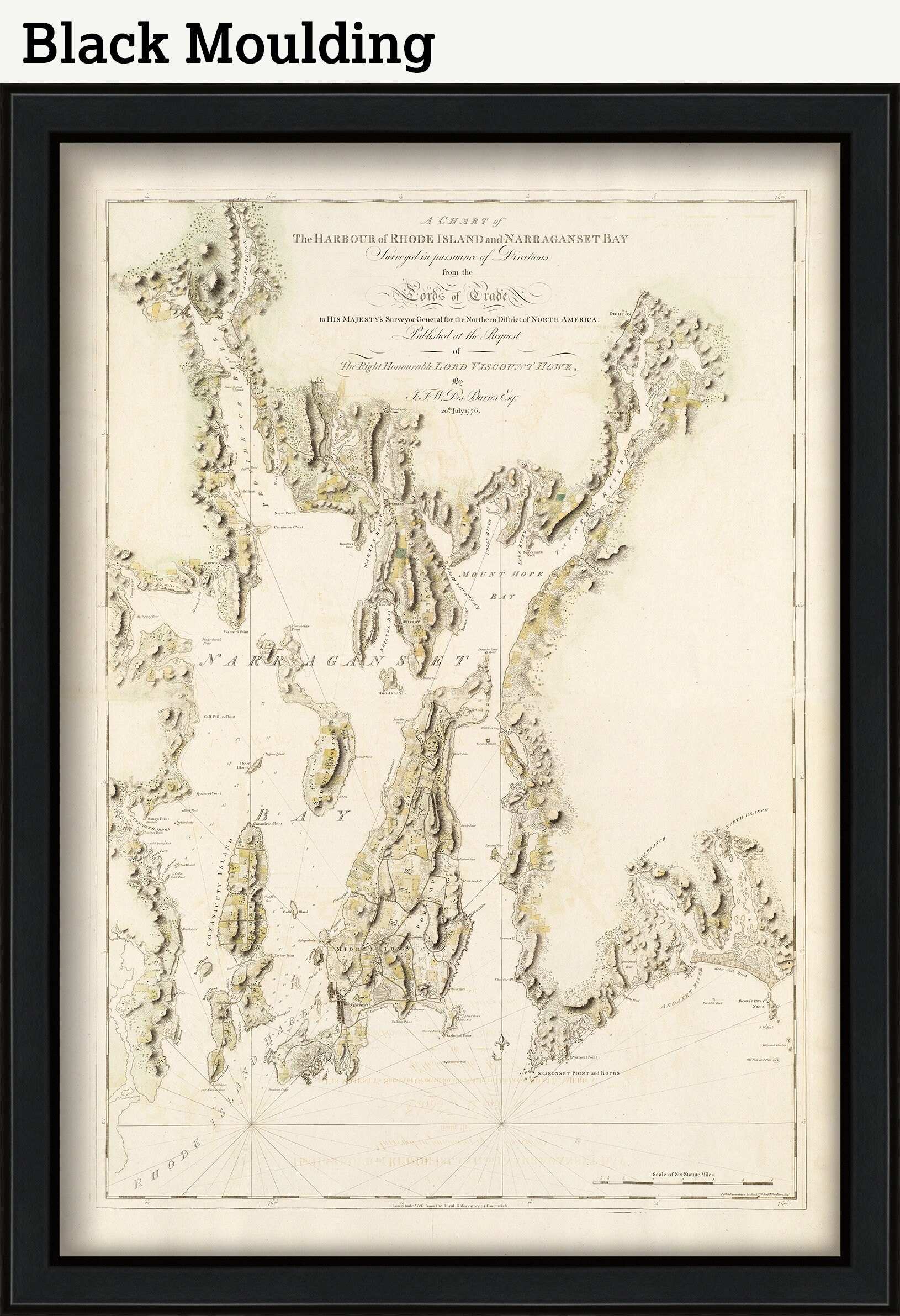
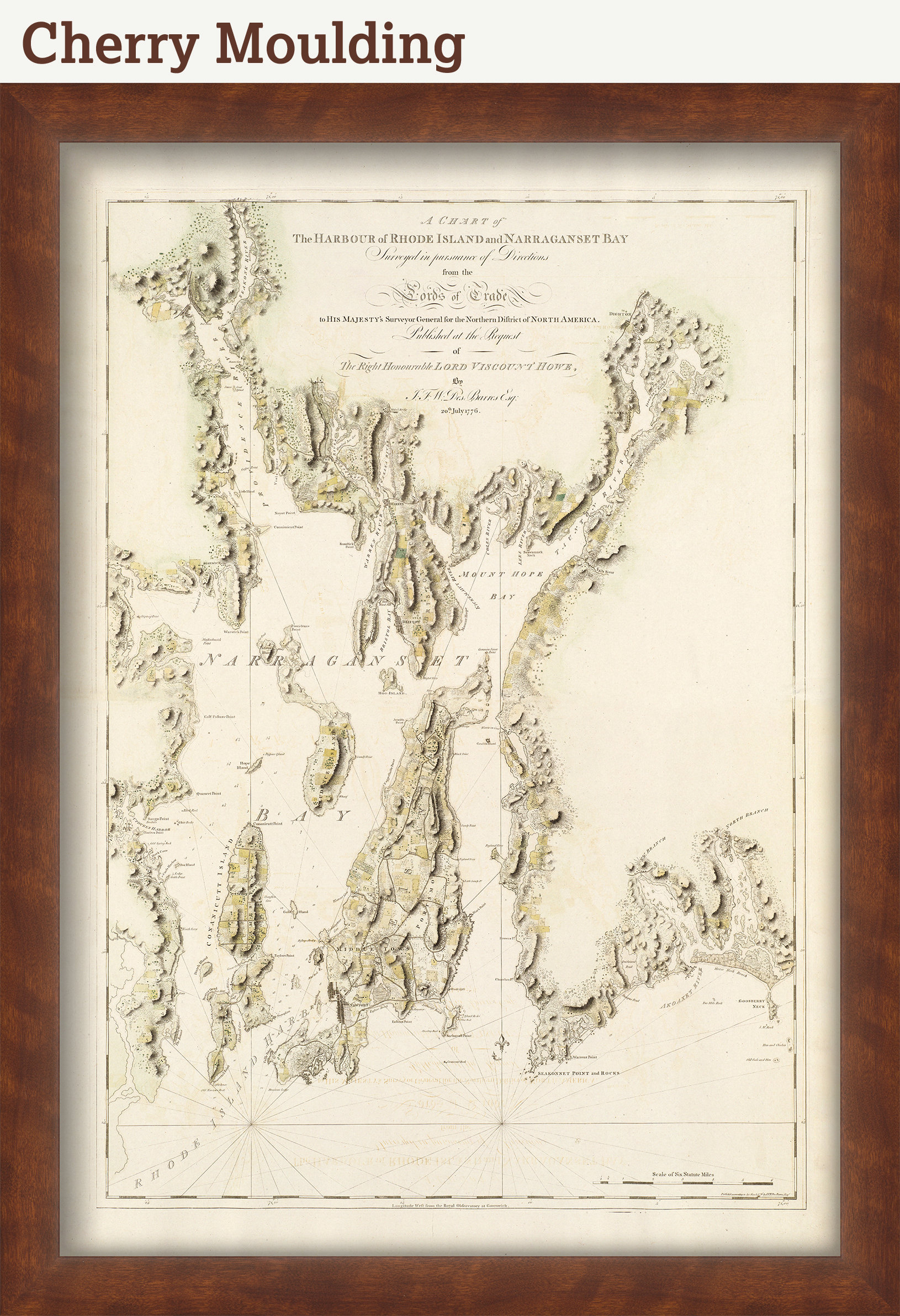
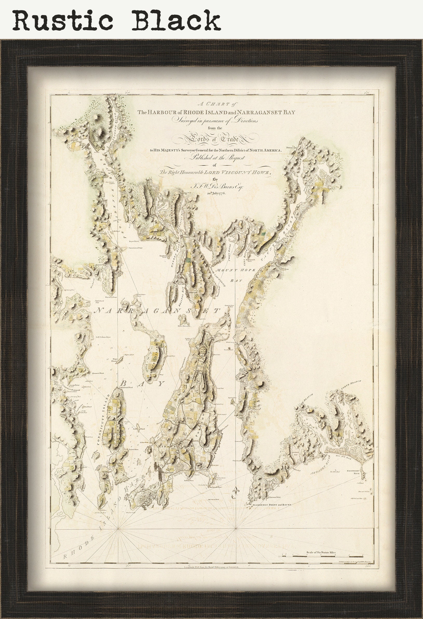
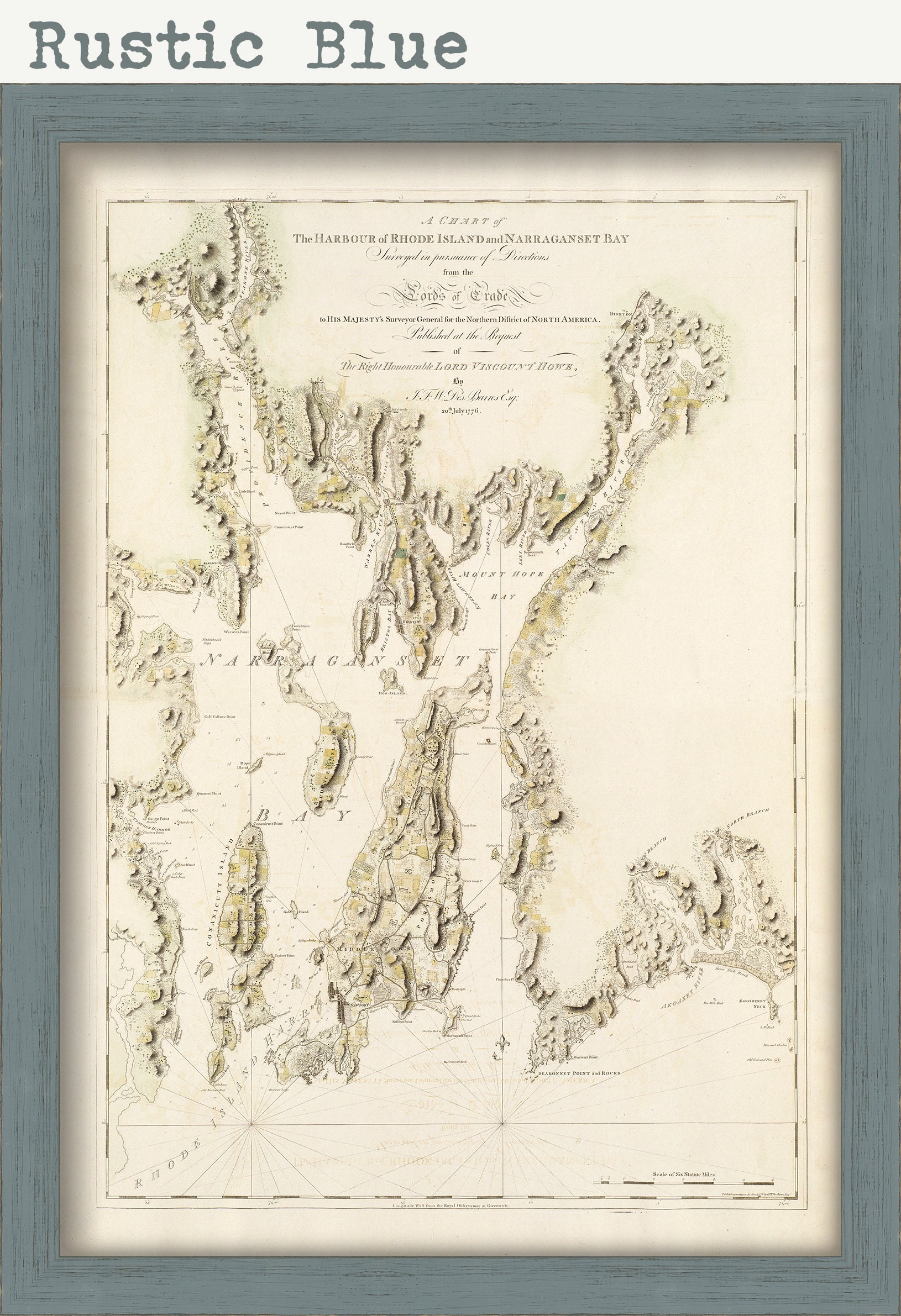
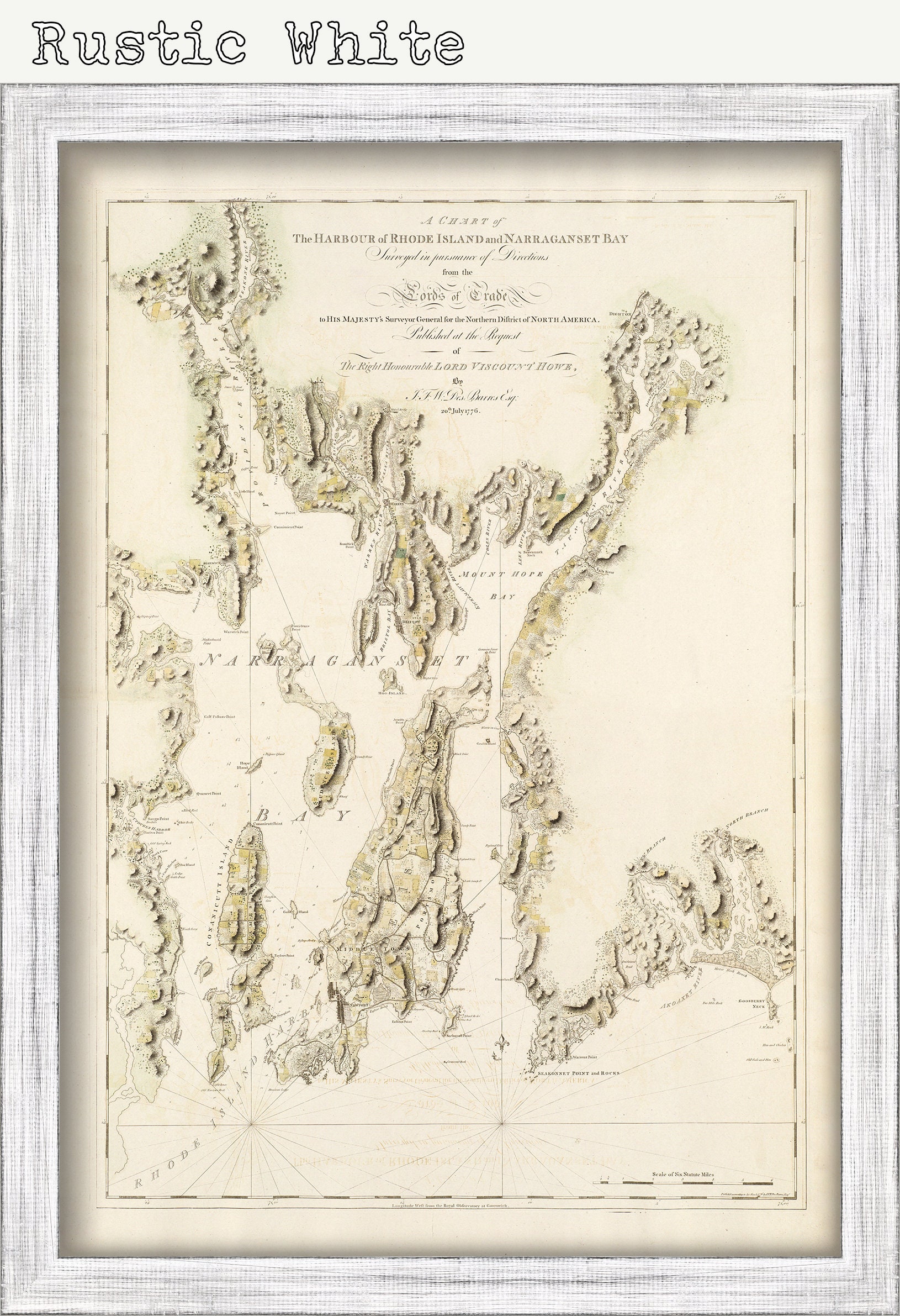
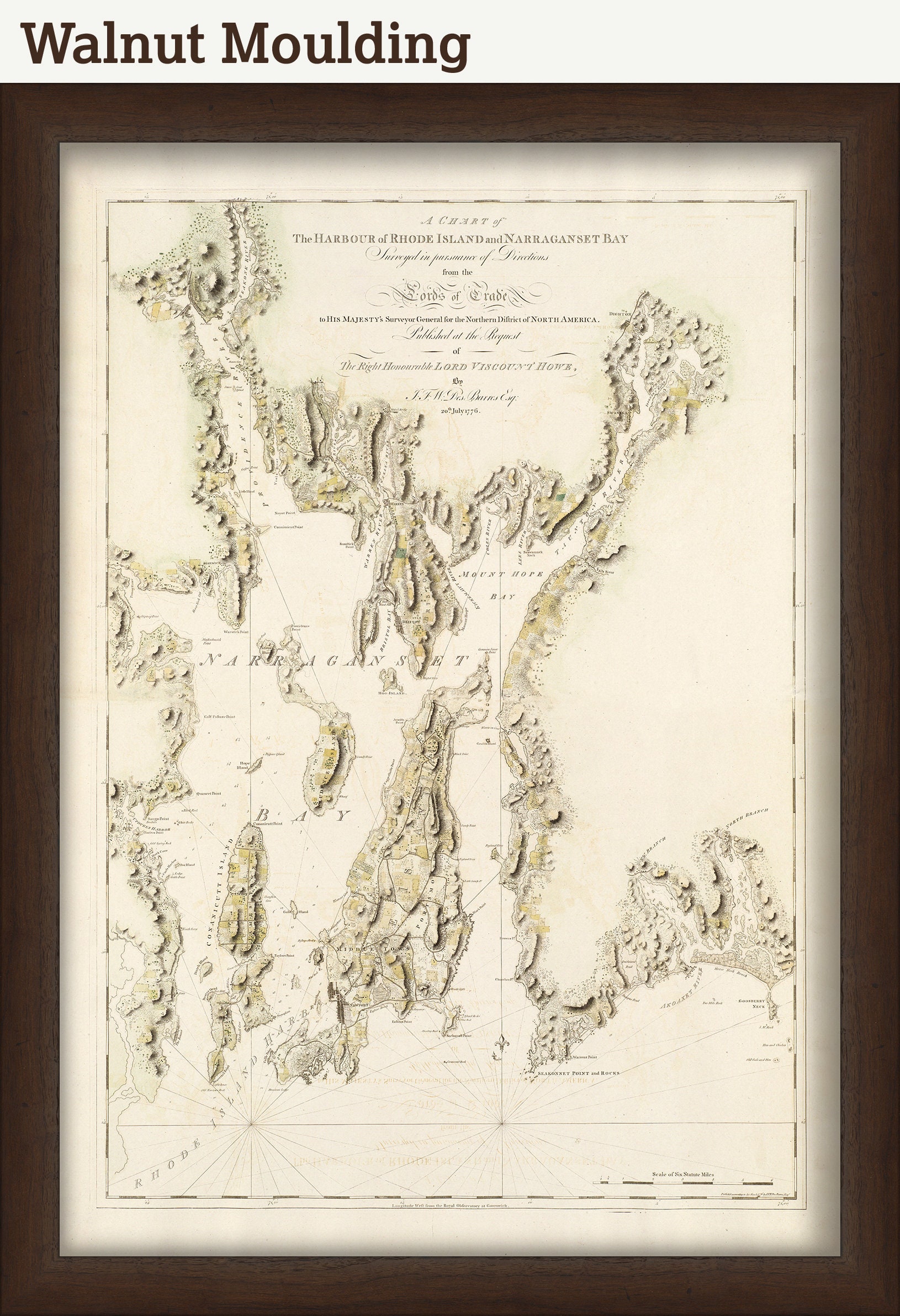
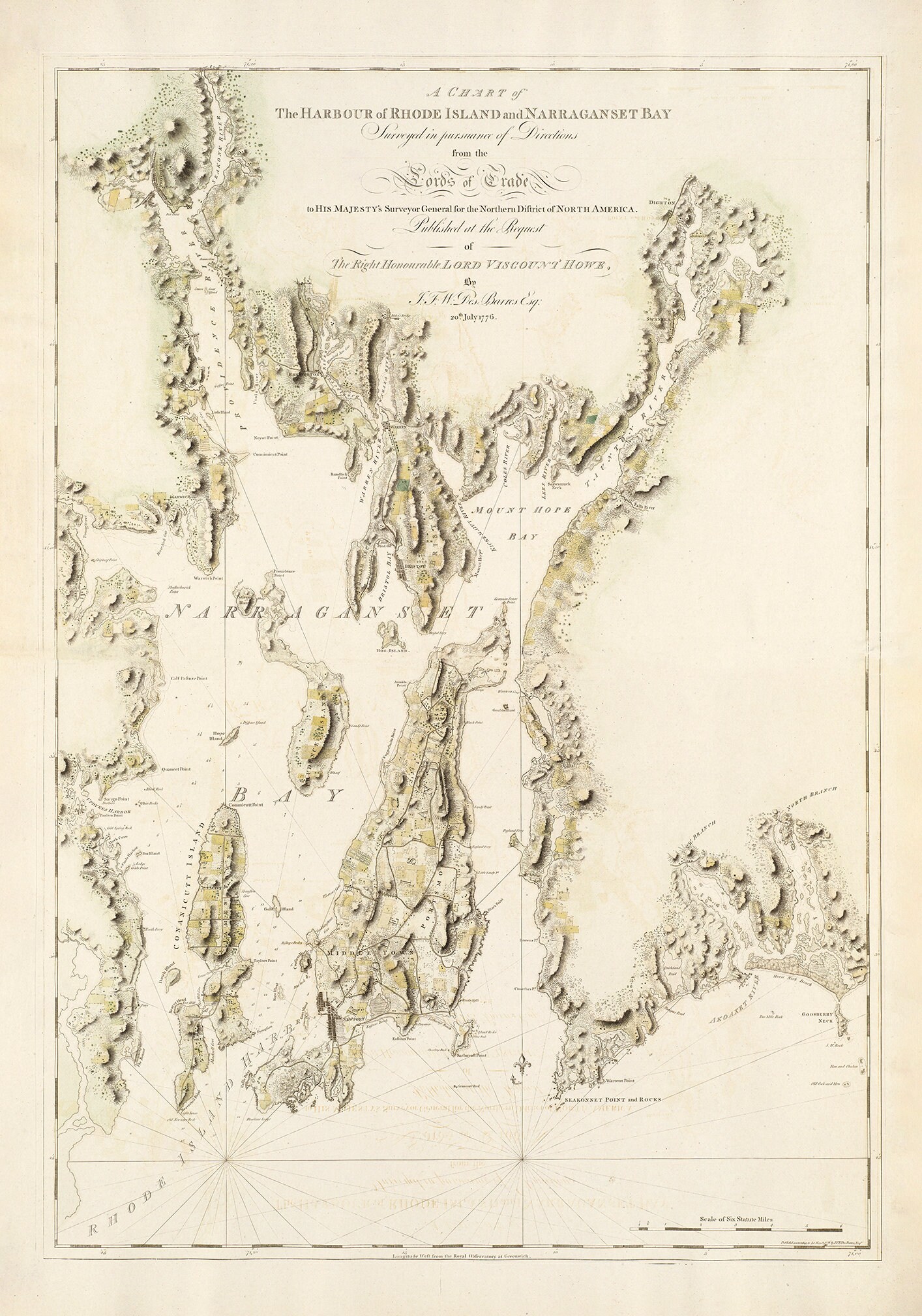
A Nautical Chart of NARRAGANSETT BAY, Rhode Island by Des Barre 1776. Des Barres is best known for the Atlantic Neptune, was a remarkable, multi-volume set of sea charts and coastal views prepared from recent surveys, some of which were overseen by Des Barres in Nova Scotia after the Seven Years’ War. The maps, charts, and views were prepared under the supervision of Des Barres and employed as many as twenty engravers and assistants. They were produced over the course of a decade, from 1774 to 1784, in time to be used by the Royal Navy in the American Revolution.
This MAP is printed on heavy matte fine art paper with archival inks.
Framed replica maps include dry mounting, UV filtering glass, and your choice of six mouldings, wired and ready to hang upon delivery. All mouldings are approximately 1.5" wide. Please factor in an additional 3" to the listed size for framed items.
Custom sizes are available. If you are interested in a custom size, please let us know through the "ask a question" button in this listing.
Retailers who would like to carry our Maps, please contact us through the "ask a question" button in this listing, for information and discounts.
2460
Shipping from United States
Processing time
1-3 business days
Customs and import taxes
Buyers are responsible for any customs and import taxes that may apply. I'm not responsible for delays due to customs.
Payment Options
Returns & Exchanges
Returns & exchanges not accepted
But please contact me if you have problems with your order
I gladly accept cancellations
Request a cancellation within: 1 hours of purchase
Reviews (1)
Average:
Aug 21, 2023
It is PERFECT! Thank you so much for offering this rare item! My Father's Doctors office has this same exact picture hanging in the waiting room and over the past two years he would read and study it until they were ready to see him, and again on our way out. Now he has his own. Thank you so much again!
Renee