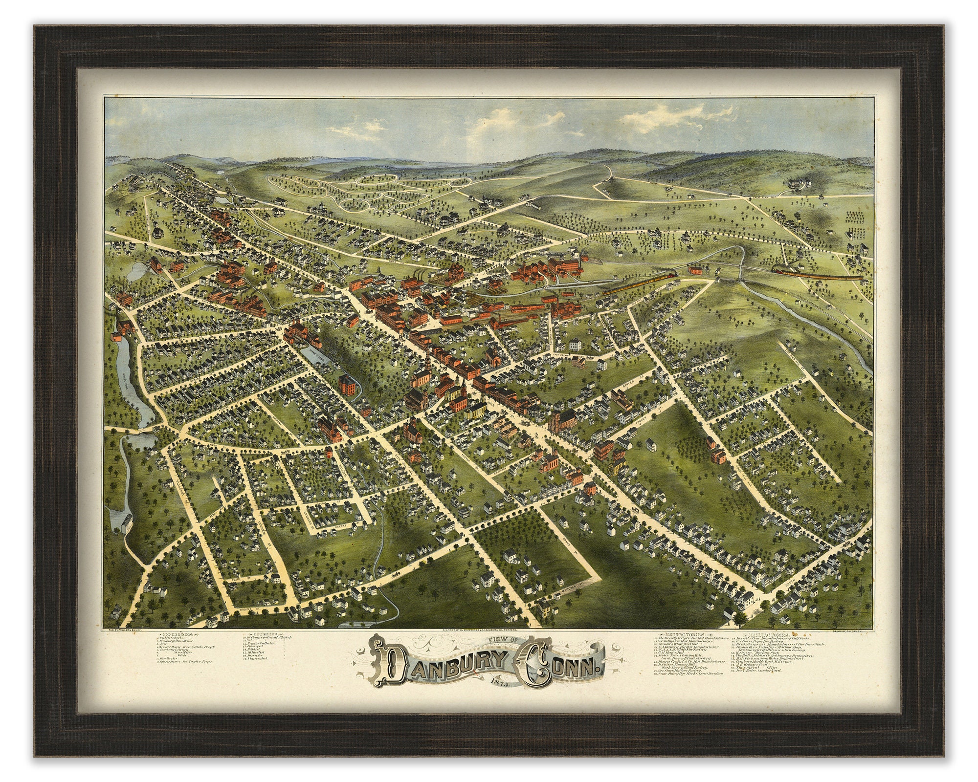
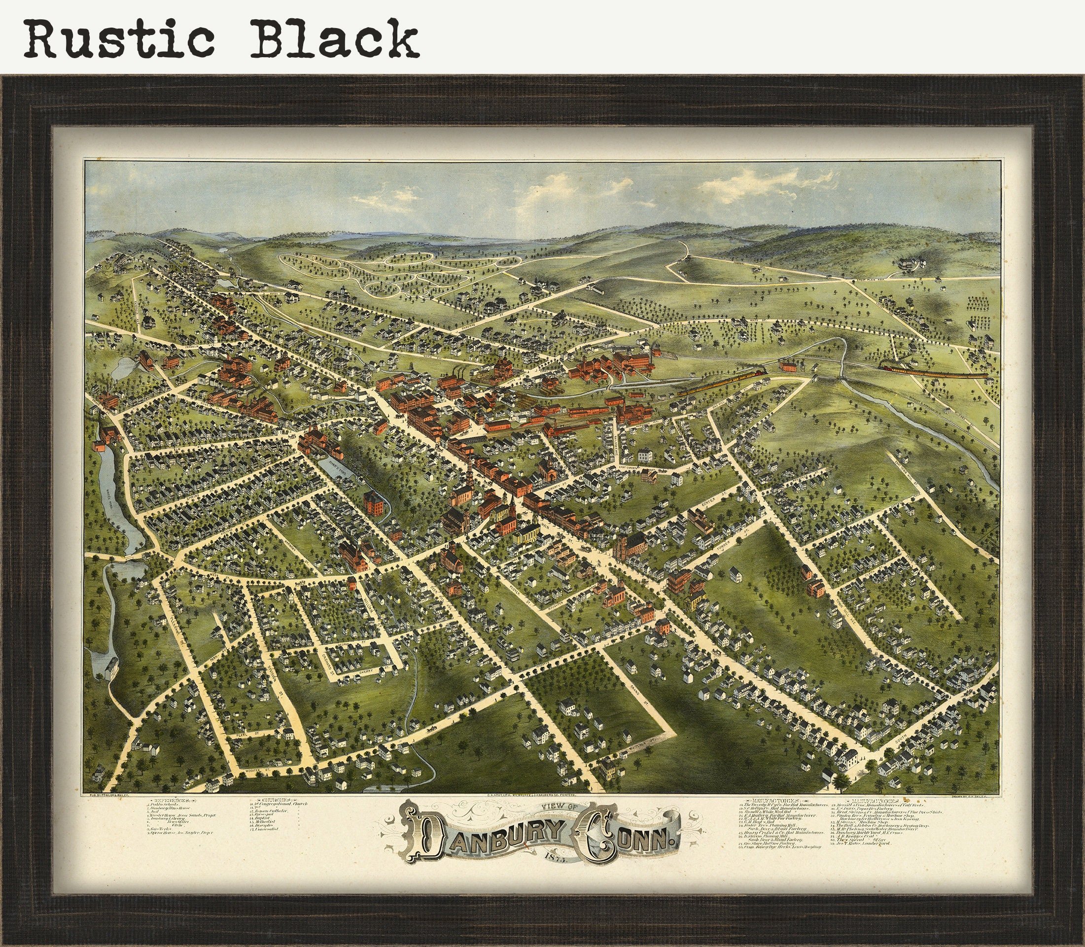
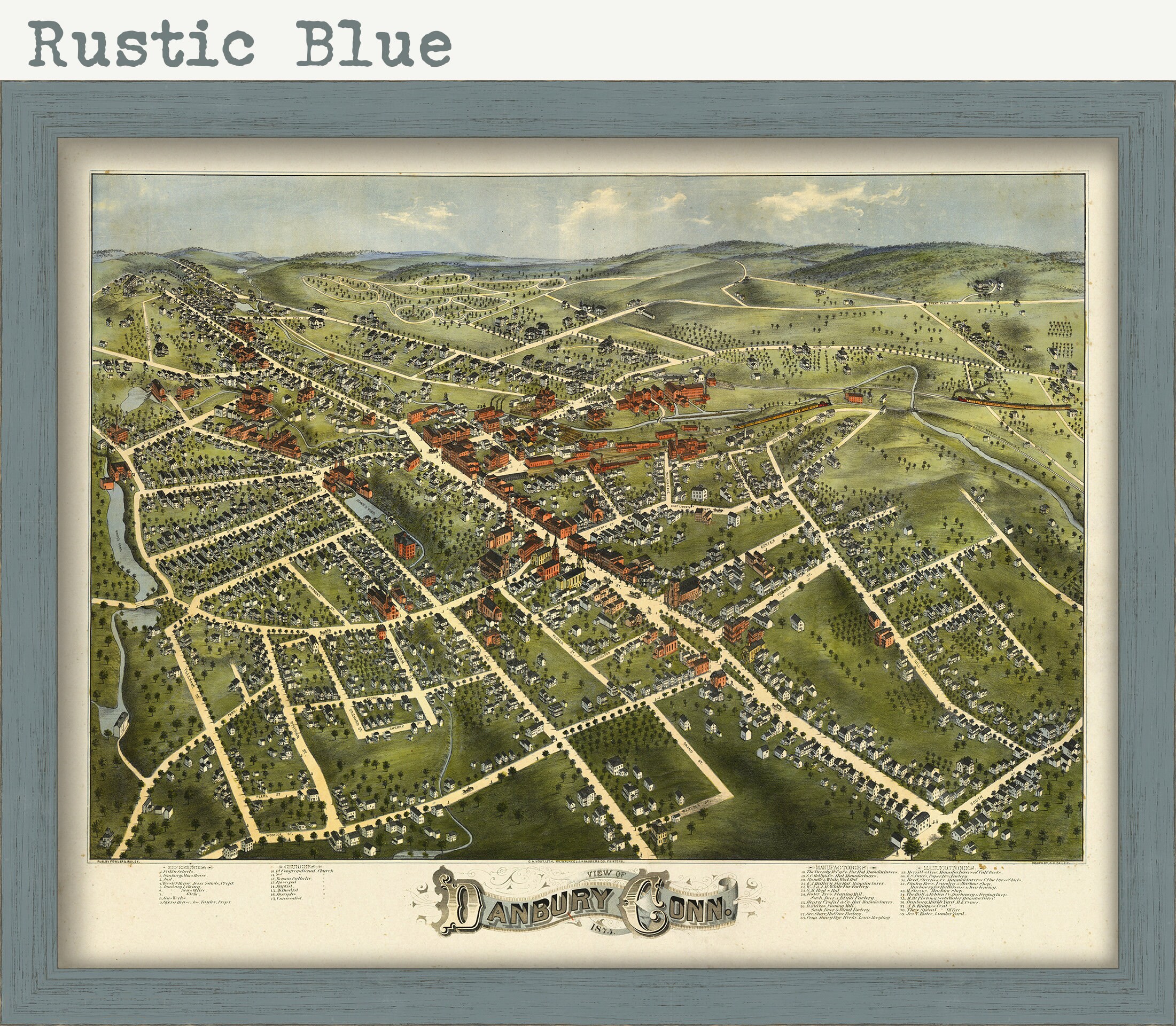
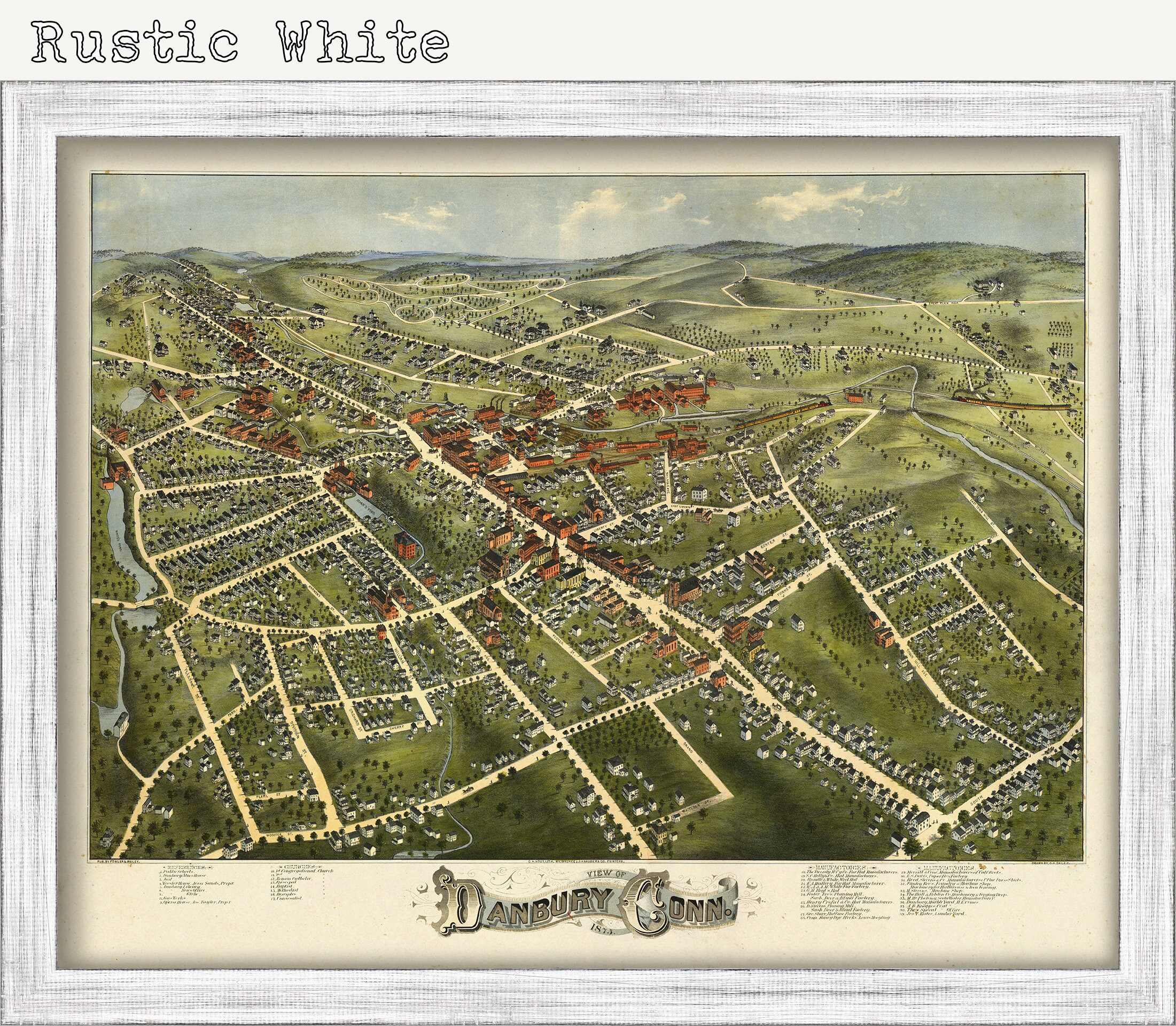
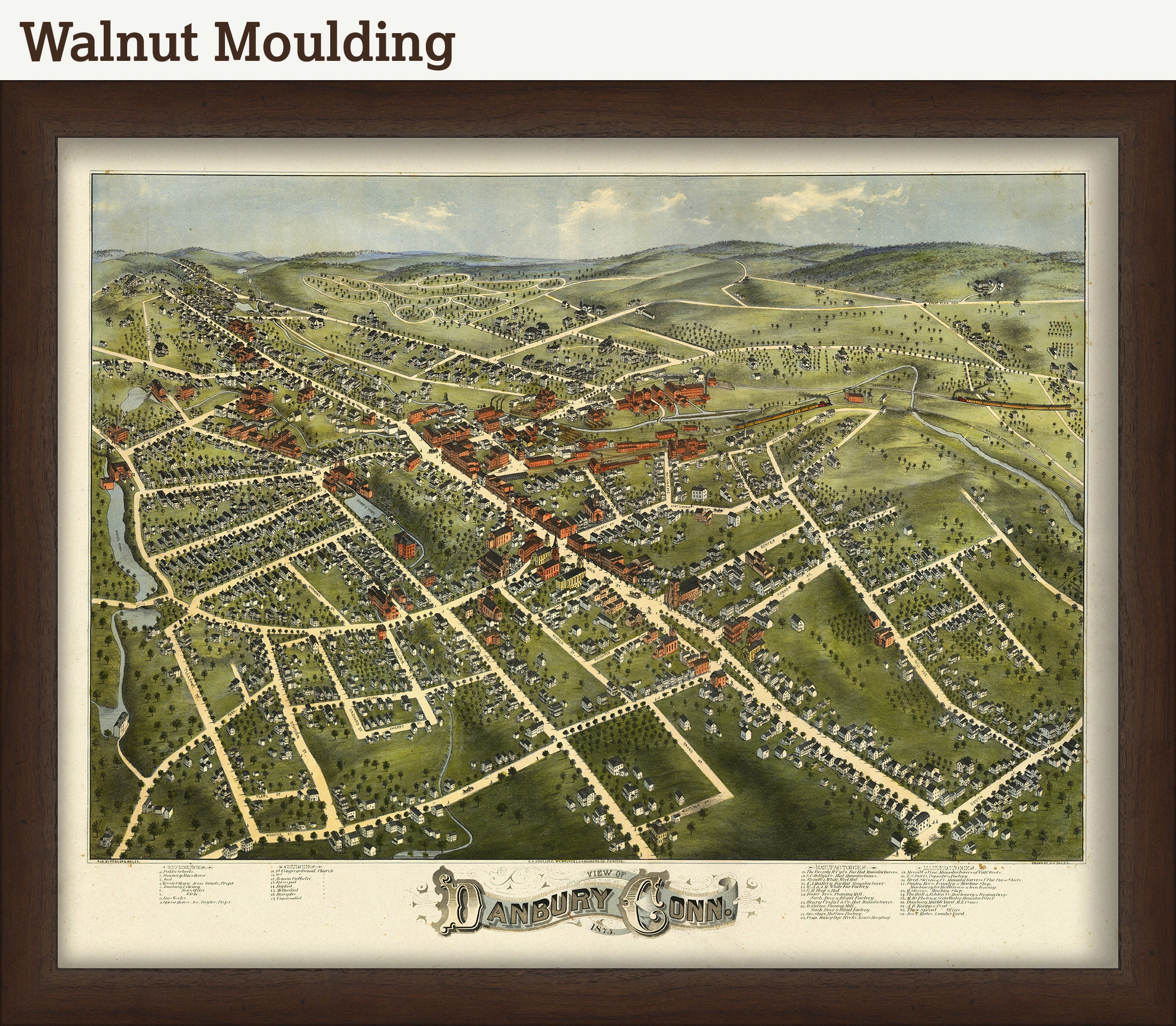
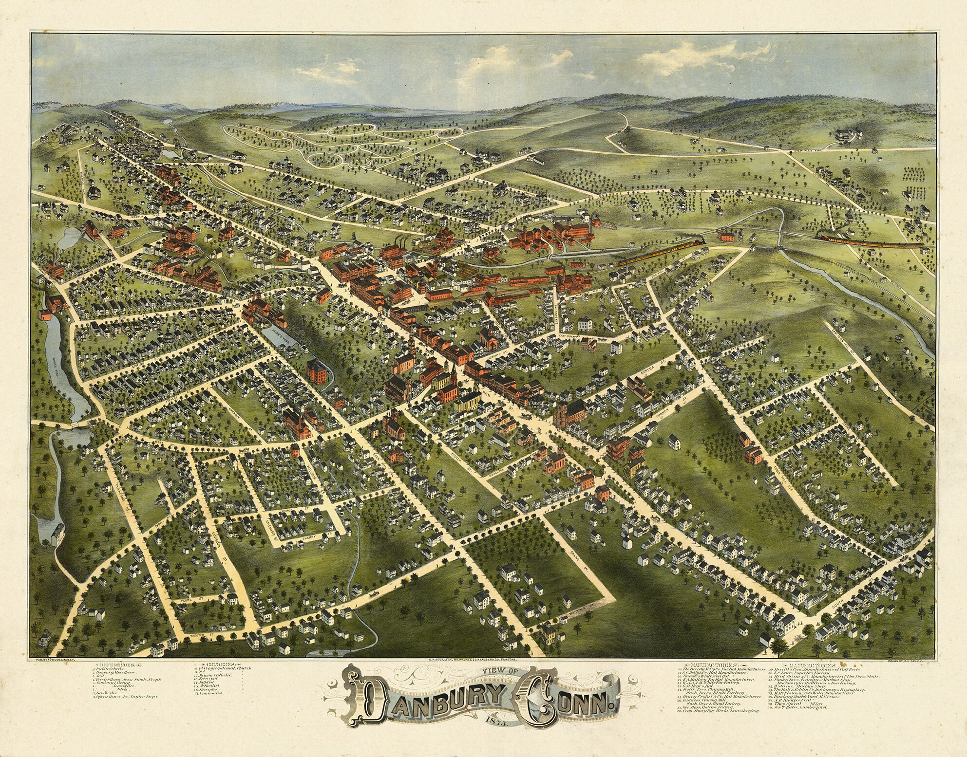
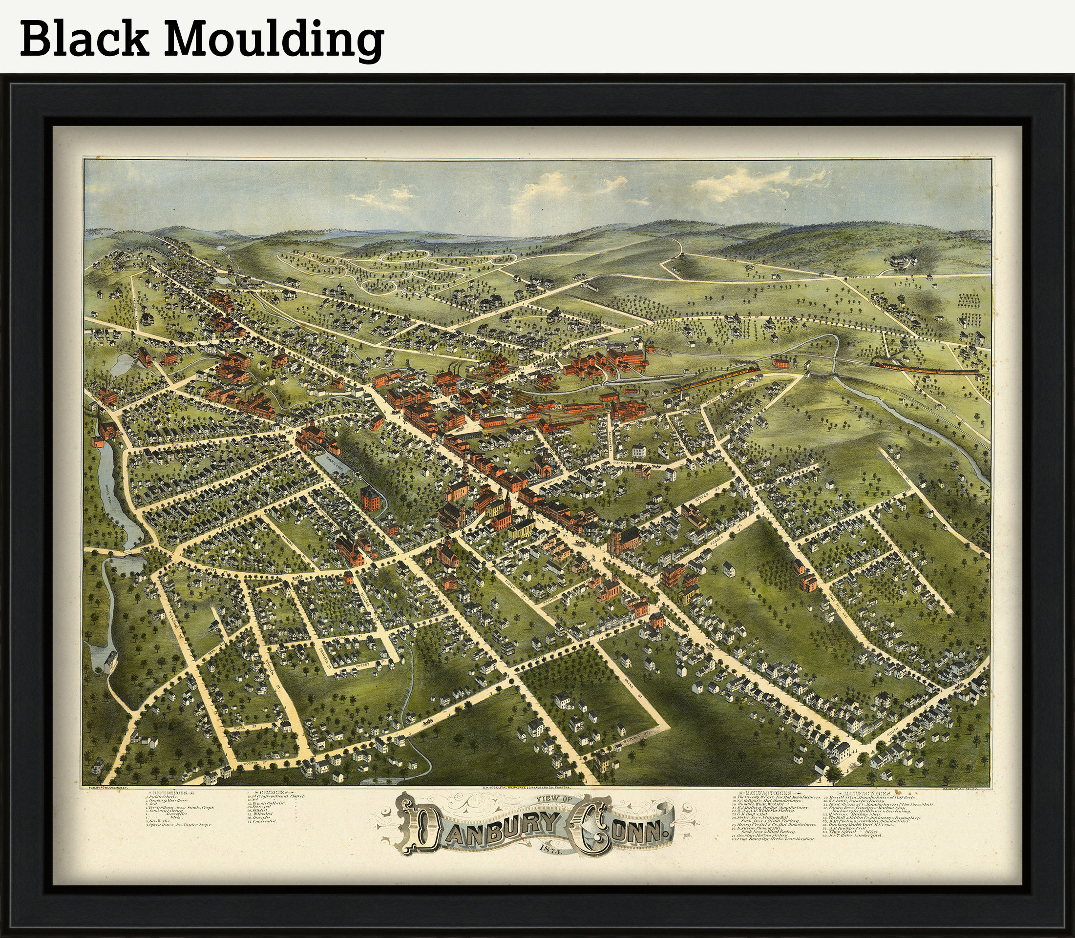
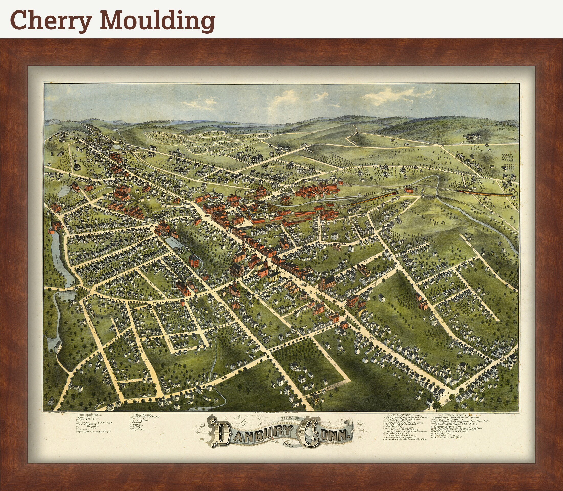
A reproduction of a colored bird's eye view of DANBURY, Connecticut, printed with archival inks on heavy fine art paper. This map was originally published in 1875. Bird’s-eye views appear as something between a panoramic view and a map, as though they were drawn by the artist while he was suspended in a hot-air balloon. In fact, they were drawn by hand using, most often, two-point perspective to produce a three-dimensional rendering. The city views are surprisingly accurate and represent a much neglected source for understanding the history of an area.
ARCHIVAL INKS ON HEAVY MATTE FINE ART PAPER
Framed maps include drymounting, UV filtering glass, and your choice of one mouldings, wired and ready to hang upon delivery. All mouldings are 1.5" wide. Please factor an additional 3" to the listed size for all framed items
Custom sizes are available. If you are interested in a custom size, please let us know through the "ask a question" button in this listing.
Retailers who would like to carry our Maps, please contact us through the "ask a question" button in this listing, for information and discounts.
2437
Shipping from United States
Processing time
1-3 business days
Customs and import taxes
Buyers are responsible for any customs and import taxes that may apply. I'm not responsible for delays due to customs.
Payment Options
Returns & Exchanges
Returns & exchanges not accepted
But please contact me if you have problems with your order
I gladly accept cancellations
Request a cancellation within: 1 hours of purchase