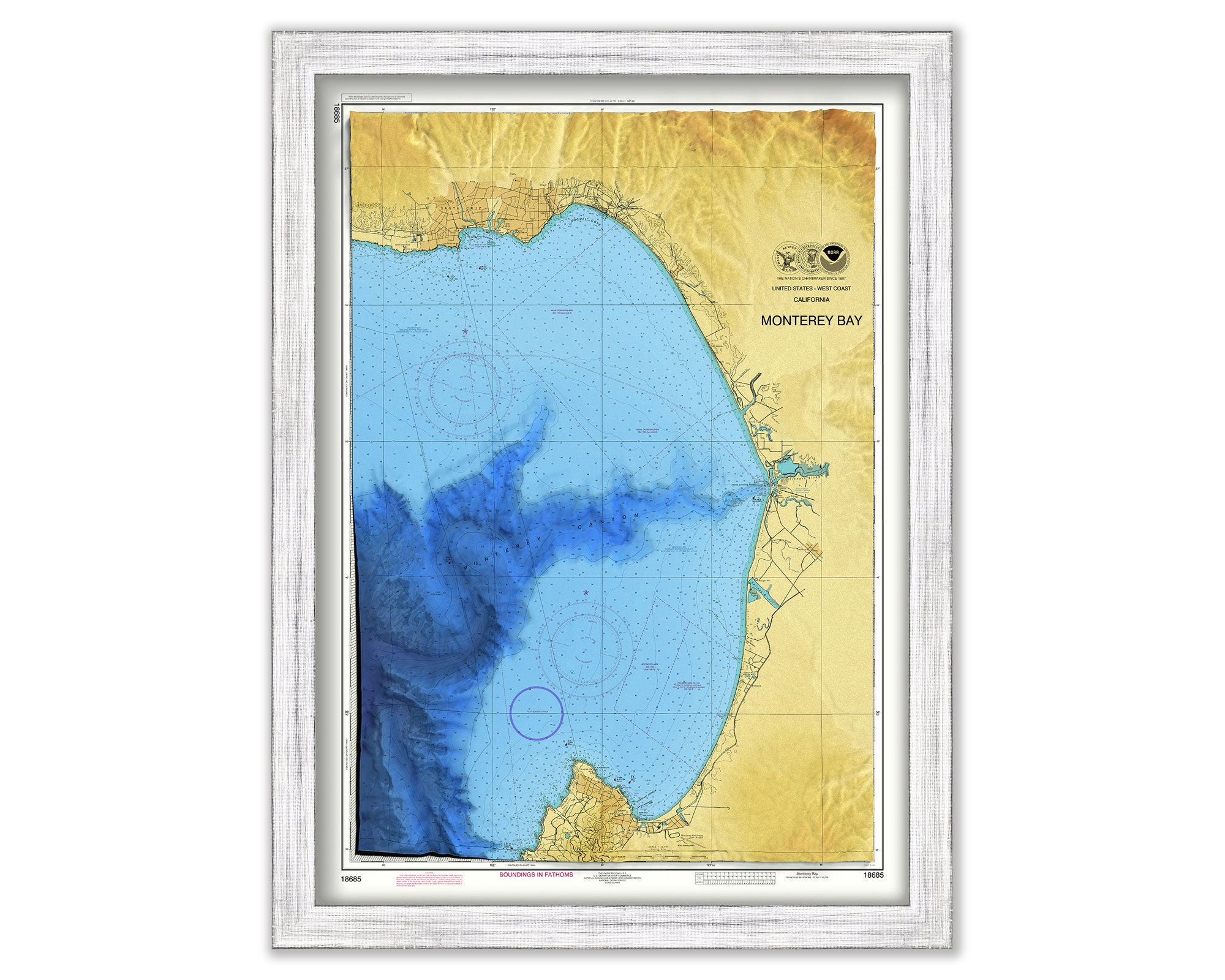
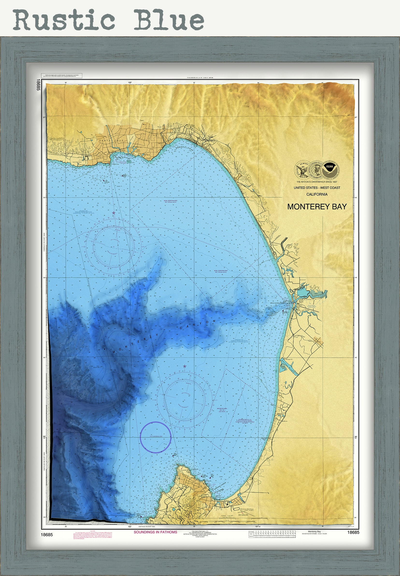
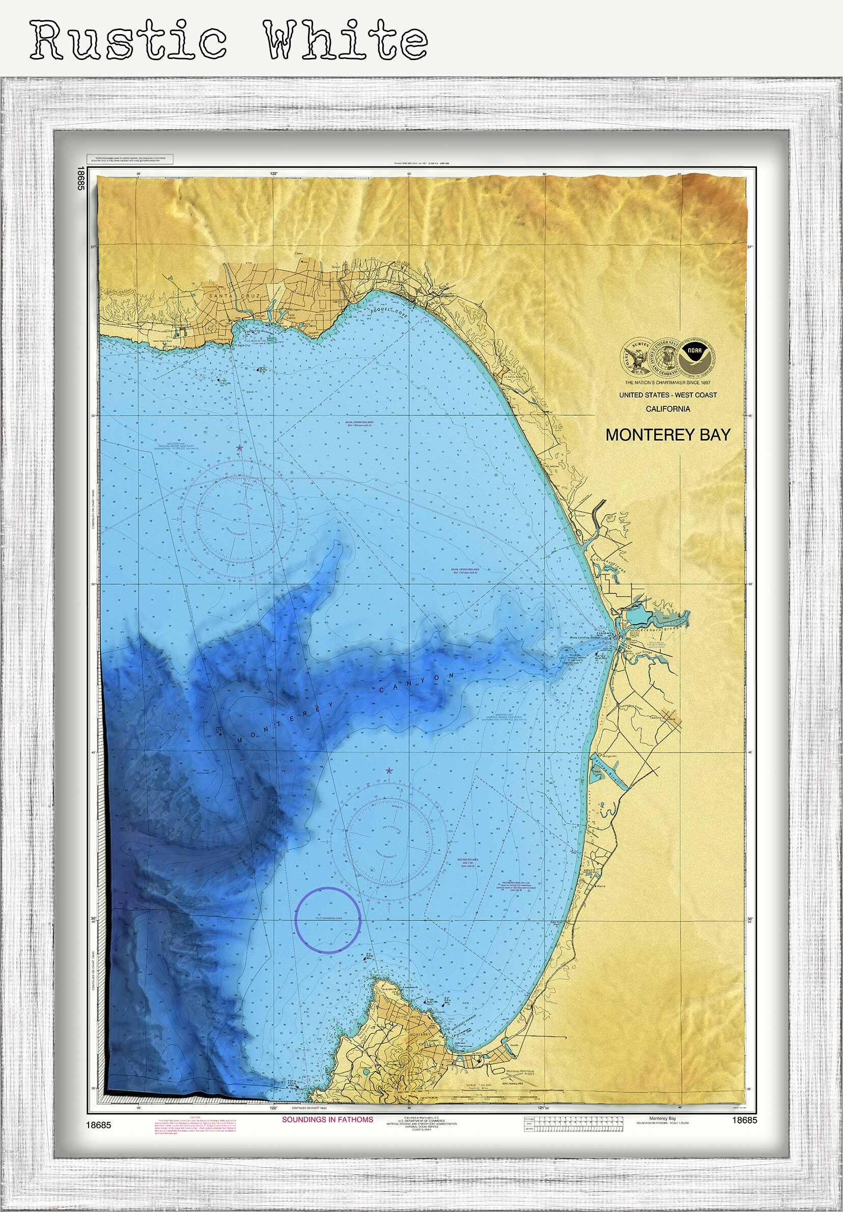
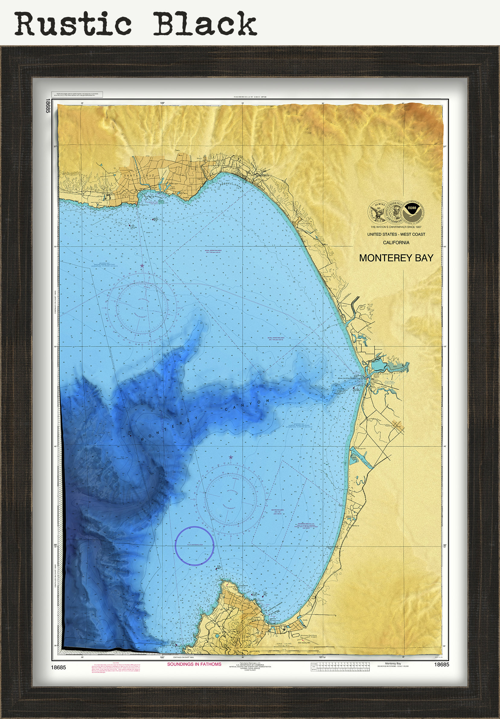
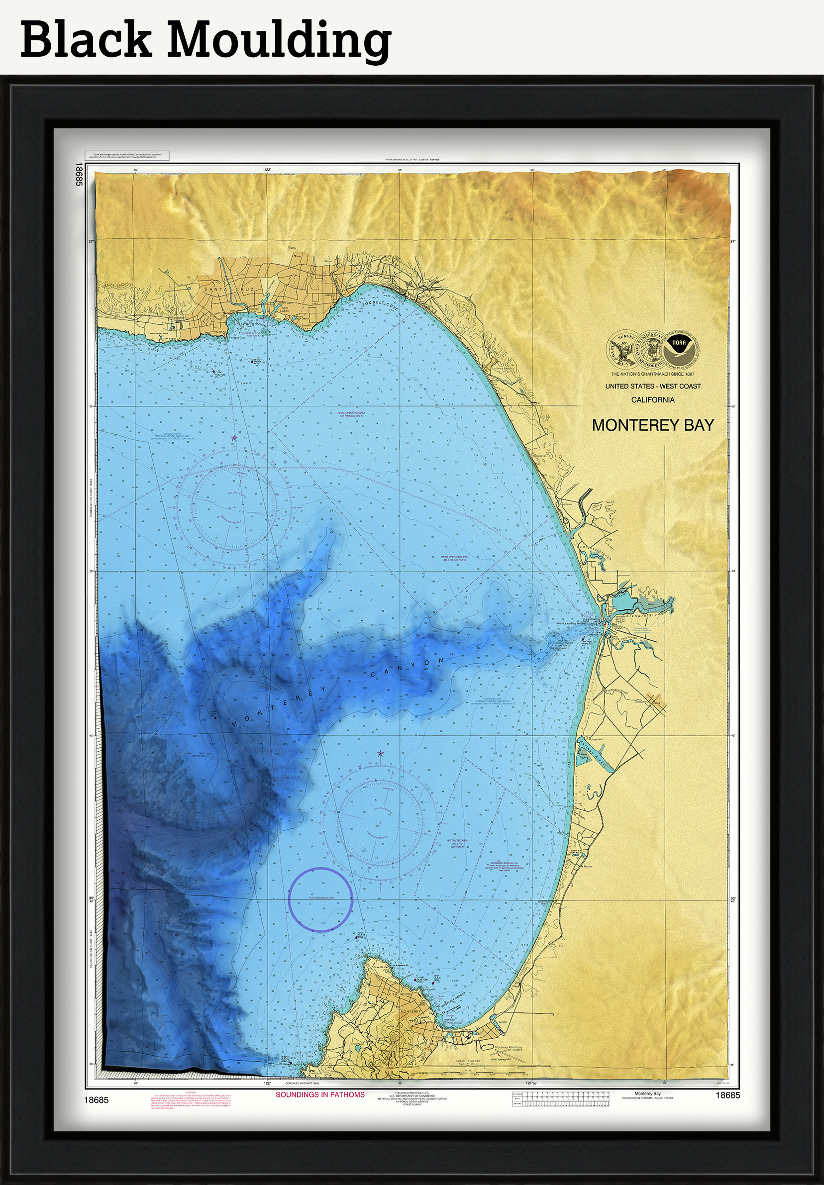
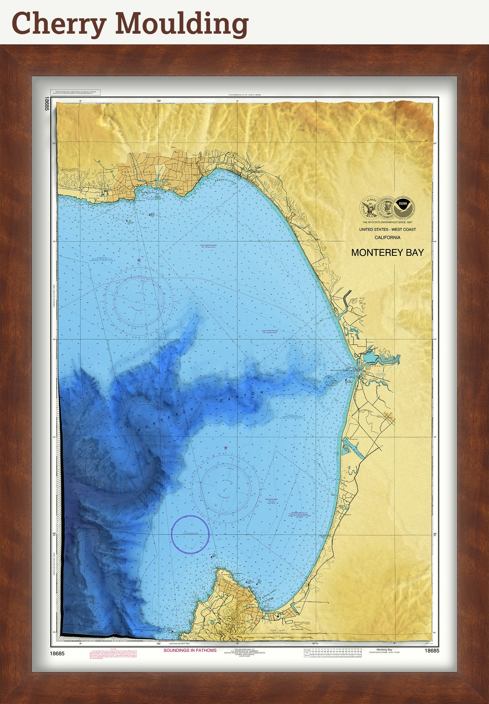
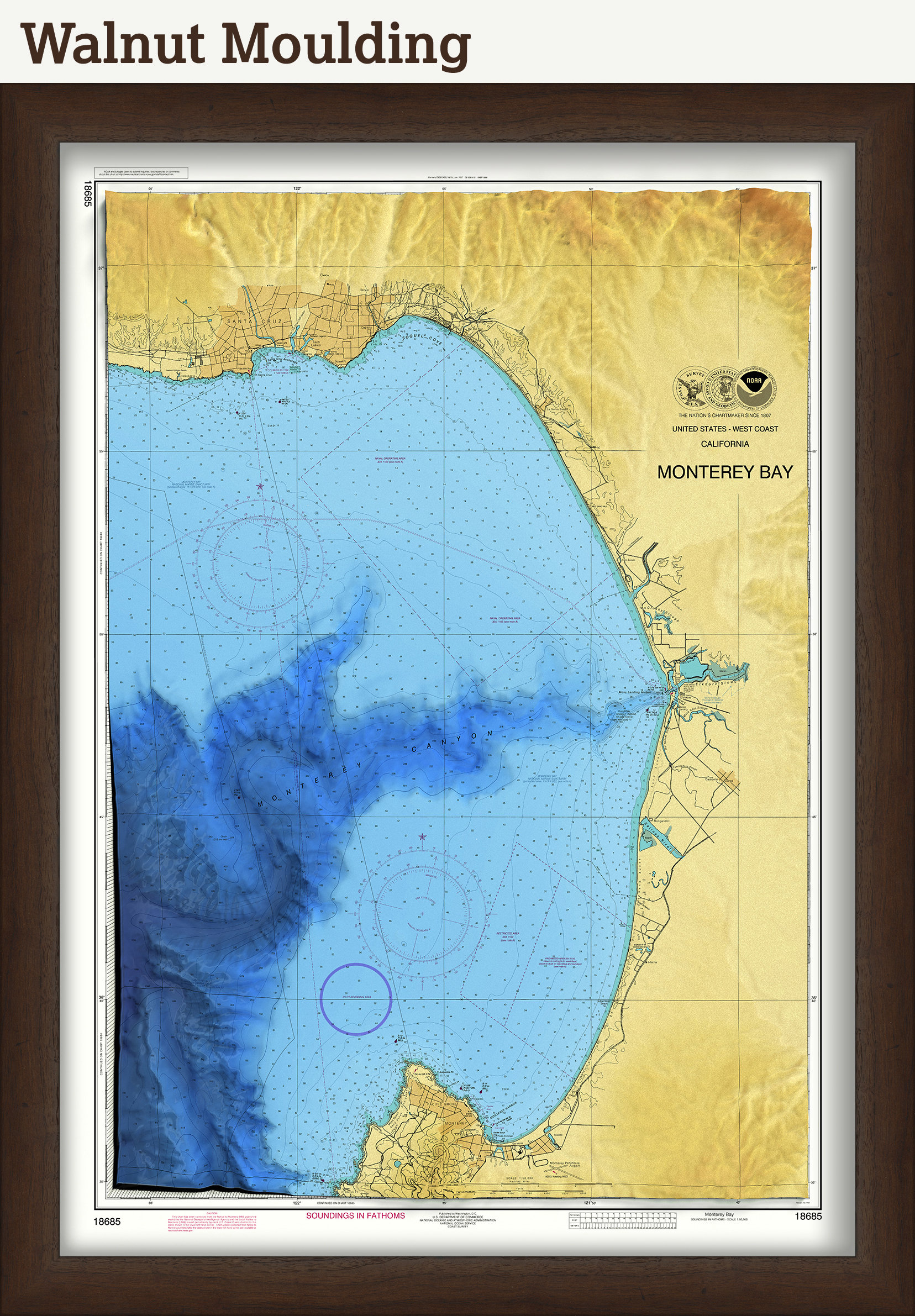

MONTEREY BAY, California - Nautical Chart - Enhanced Bathymetric Data Rendering
$40.00
A stylized reproduction of the NOAA raster Nautical chart of Monterey Bay, California. The elevation and bathymetric data of the chart has been enhanced with GIS layers and 3d rendering to aid in visualizing the shallow contours of the bay rapidly dropping into the depths of the entrance of the Monterey Canyon. The map extent is from Santa Cruz on the northern portion to Cyprus Point in the South.
Not intended for use in navigation.
Custom sizes are available. If you are interested in a custom size, please let us know through the "ask a question" button in this listing.
This image is printed on heavy matte fine art paper with archival inks. Framing is available. Framed charts include drymounting, UV filtering glass, and your choice of six mouldings, wired and ready to hang upon delivery. All mouldings are approximately 1.5" wide. Please factor in an additional 3" to the listed size for framed items.
Retailers who would like to carry our Maps and Prints, please contact us through the "ask a question" button in this listing, for information and discounts.
2486
Shipping from United States
Processing time
1-3 business days
Customs and import taxes
Buyers are responsible for any customs and import taxes that may apply. I'm not responsible for delays due to customs.